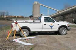
The professional staff at Civil Design Group, Inc. is dedicated to delivering accurate surveys in a timely fashion. All members of the staff are required to have a working knowledge of the art of surveying.
Our survey team has extensive experience in completing the following types of surveying projects:
- Topographic Surveys – This is a three-dimensional survey that records the location and elevation of existing land features. The topographic survey is particularly useful in land development.
- Right-of-Way & Route Surveys – The right-of-way and route surveys are usually performed in conjunction with the design of roadways, railroads, water lines, sanitary sewers, and storm sewers.
- Subdivision and Boundary Surveys – Most residential surveys performed by Civil Design Group fall into this category. Subdivision surveys are implemented when a property owner wishes to divide or combine their property.
- ALTA/ACSM Surveys – This is a survey performed according to the specifications of the American Land Title Association and American Congress on Surveying and Mapping. The ALTA/ACSM survey is required by businesses, title companies and financial institutions. This type of survey is based on recognized national standards and is more extensive than the typical boundary survey.
- Construction Staking – This is the portion of surveying that links the design phase to the construction phase of a project. Civil Design Group performs construction layout for buildings, roadways, water lines, sanitary and storm sewers, parking lots, and countless other developmental needs.